The Burrow
Apr 1, 2026
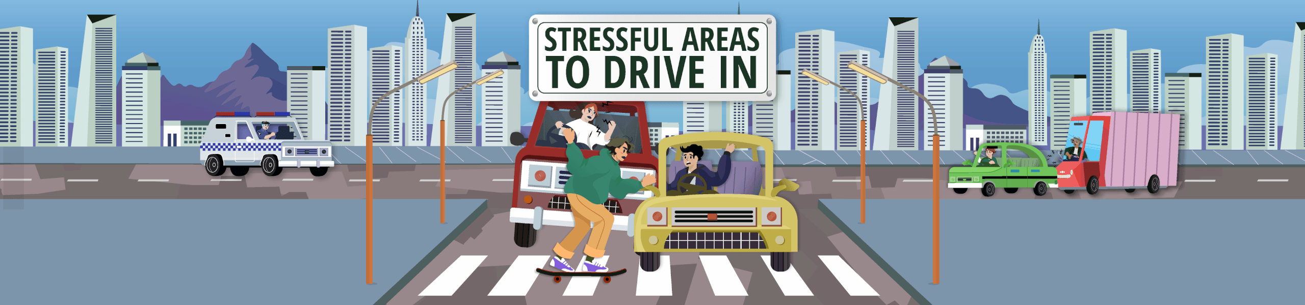
Pressure behind the wheel has a real impact on the overall motoring experience, particularly in some of the most stressful countries to drive in. Heavy traffic, poor road conditions, unpredictable weather and high accident rates all contribute to driver fatigue and frustration. Over time, navigating through such conditions may increase the likelihood of collisions, accelerate wear and tear on vehicles, and turn everyday commutes into draining experiences.
Across the globe, some locations stand out as more stressful for drivers. Congestion, low average speeds, long rush hour delays and higher road fatality rates all play a role in shaping how challenging it feels to get from A to B. Understanding where these pressures are most intense can help motorists to better prepare, adapt their driving habits and make informed decisions about routes.
To find out more, the car insurance comparison experts at Compare the Market analysed driving data across a range of major cities in the US, Australia and Europe. The results identify where stress levels are highest and what factors contribute most to the pressure drivers face.
For the rankings, the datasets for the US, Australia and Europe examined the most populated cities using numerous key indicators. Each factor was normalised to a score between 0 and 1 and weighted equally, before being combined into a total score out of 100. Cities were then ranked from highest to lowest, revealing the most stressful cities for drivers based on a comprehensive view of real-world driving pressures.
Driving conditions vary dramatically across America, but the data highlights three clear standouts among the most stressful cities for drivers.
Nashville ranks as the most stressful US city to drive in. Drivers experience congestion levels of 38.1%, meaning significant time is lost compared to free-flow traffic. The average speed sits at 24.4 miles per hour, while commuters lose 57 hours annually during rush hour traffic.
There are 794 motor vehicles per 1,000 people, contributing to road density, and the road fatality rate stands at 183 per million people. Road quality is rated as 94.1% acceptable, while average annual rainfall measures 4.3 inches. Together, these factors influence overall road conditions and stress levels.
Houston records congestion of 40.8% and an average speed of 28.9mph. Drivers lose 56 hours annually in rush hour traffic. Meanwhile, the city has 605 vehicles per 1,000 people, reflecting heavy car reliance.
The road fatality rate is 137.1 per million, road quality is rated at 76.8% acceptable, and annual rainfall averages 4.1 inches. Combined, these elements place Houston firmly among the most stressful cities for drivers in the US.
Seattle shows congestion of 44.9%, with average speeds dropping to 21.8mph. Drivers lose 69 hours annually in peak traffic. Also, vehicle density stands at 617 per 1,000 people.
The road fatality rate is 101.8 per million, road quality sits at 70.4% acceptable, and annual rainfall averages 4.6 inches, which is the highest of the top three. These weather and infrastructure pressures significantly affect overall road conditions.
At the opposite end of the spectrum, Omaha ranks as the least stressful US city for drivers. Congestion is just 14.0%, average speeds are higher at 40.7mph, and commuters lose only 14 hours annually in rush hour traffic.
There are 705 vehicles per 1,000 people, while the road fatality rate stands at 113.2 per million. Road quality is rated 92.6% acceptable and annual rainfall averages 3 inches, contributing to comparatively calmer road conditions.
Driving stress is not limited to major global cities. The data shows clear differences across Australian states and territories when it comes to congestion, safety and road conditions. Below are the three highest-ranking regions based on overall stress scores.
South Australia ranks highest, with congestion at 55.1% and an average speed of 25.4km per hour. Here, drivers lose 109 hours annually during rush hour traffic.
Vehicle density reaches 856 per 1,000 people, while the road fatality rate is 48.5 per million. There are 87.9 potholes or damaged roads per 100,000 people and annual rainfall averages 161mm. These combined factors greatly influence overall road conditions and daily stress.
Queensland records congestion of 40.5% and an average speed of 30.6km/h, with drivers losing 77 hours per year in rush hour traffic.
There are 859.7 vehicles per 1,000 people, the road fatality rate stands at 54.1 per million, and there are 331.4 potholes or damaged roads per 100,000 residents. Annual rainfall averages 817.6mm, with weather playing a major role in road conditions.
Victoria shows congestion of 52.9% and an average speed of 26.2km/h. Drivers lose 103 hours annually in peak traffic, which is influenced by 180.4 potholes or damaged roads per 100,000 people.
Vehicle density stands at 798.5 per 1,000 people and road fatality rates are 40.3 per million. In addition, annual rainfall averages 544.6mm, adding another layer of complexity to road conditions.
Meanwhile, the ACT ranks as Australia’s least stressful region for motorists. Congestion is 33.6% with an average speed of 36km/h, and drivers lose 56 hours annually in rush hour traffic.
There are 718.5 vehicles per 1,000 people and the road fatality rate is 23.2 per million. Road quality here is high, with just 5.1 potholes or damaged roads per 100,000 people. Also, annual rainfall averages a relatively low 426.9mm, contributing to more stable road conditions overall.
The European data highlights notable contrasts across major cities, identifying some of the most stressful cities for drivers.
Dublin records congestion of 72.9%, which is the highest in Europe. Average speeds drop to 17.4km/h and drivers lose a significant 191 hours annually during rush hour traffic.
Vehicle density is 426 per 1,000 people, road fatality rates stand at 23 per million, road quality scores 4.86 out of 7, and annual rainfall averages 77mm.
Bucharest shows congestion at 62.5%, with an average speed of 18.5km/h and 171 hours lost annually in peak traffic.
Vehicle density reaches 651 per 1,000 people, road fatality rates are 53 per million, road quality scores 3.49 out of 7, and rainfall averages 58mm per year.
Athens records congestion of 54.7%, average speeds of 19km/h, and 143 hours lost annually by drivers.
Vehicle density is the highest of any European city at 872 per 1,000 people, road fatality rates stand at 49 per million, road quality scores 4.59 out of 7, and annual rainfall averages 32mm.
On the opposite end is Oslo, which ranks as the least stressful European city for motorists. Congestion is 33.2%, average speeds are much higher at 30.6km/h, and drivers lose a comparatively low 70 hours annually in peak traffic.
Vehicle density stands at 500 per 1,000 people, road fatality rates are 12 per million, road quality scores 4.62 out of 7, and annual rainfall averages 84mm. All of these factors contribute to steadier traffic and more reliable road conditions.
While established cities dominate the rankings, the data also highlights emerging pressure points where driving stress is rising.
In the US, Fort Worth (Texas) records congestion of 28.3%, average speeds of 37mph and 30 hours lost annually during rush hour traffic, alongside 668 vehicles per 1,000 people. These factors signal growing strain as the city expands.
In Europe, Brussels stands out with 46.2% congestion, 146 hours lost in peak traffic each year and road quality rated at 4.32 out of 7, indicating mounting infrastructure pressure.
These upward trends reinforce the importance of proactively addressing traffic management, infrastructure investment and safety planning, particularly in regions that may soon join the ranks of the most stressful cities for drivers if pressures continue to intensify.
Driving in high-pressure areas means that staying alert, allowing extra travel time and adapting to changing road conditions can make a real difference to safety. Reducing distractions, keeping a safe following distance and adjusting speed during heavy congestion or poor weather are simple but effective ways to lower risk.
Adrian Taylor, Executive General Manager of General Insurance, says: “Stressful driving environments can increase the likelihood of accidents, which is why motorists should not only drive carefully but also ensure they have an adequate car insurance policy in place. Having cover in place provides peace of mind, especially in areas where traffic, road conditions and safety risks are more challenging.”
Always read the Product Disclosure Statement (PDS) and Target Market Determination (TMD) to check for inclusions, limits and restrictions before purchasing.
USA
The USA dataset ranks 50 of the most populated cities, based on how stressful they are to drive in by using 8 key factors. Each factor’s data was collected and normalised to a score between 0 and 1. If data was missing, a score of 0 was given. These scores were then combined to give each city a total score out of 100, and cities were ranked from highest to lowest.
The factors used are as follows:
The factors were indexed as follows:
All data is correct as of 13/02/26. The ranking data shown is a compilation of multiple data sources and may not be representative of real life. All data is accurate with regards to the sources provided.
Australia
The Australian dataset ranks states/territories, based on how stressful they are to drive in by using 8 key factors. Each factor’s data was collected and normalised to a score between 0 and 1. If data was missing, a score of 0 was given. These scores were then combined to give each state/territory a total score out of 100, and states/territories were ranked from highest to lowest.
The factors used are as follows:
The factors were indexed as follows:
All data is correct as of 13/02/26. The ranking data shown is a compilation of multiple data sources and may not be representative of real life. All data is accurate with regards to the sources provided.
Europe
The European dataset ranks 40 cities, based on how stressful they are to drive in by using 7 key factors. Each factor’s data was collected and normalised to a score between 0 and 1. If data was missing, a score of 0 was given. These scores were then combined to give each city a total score out of 100, and cities were ranked from highest to lowest.
The factors used are as follows:
The factors were indexed as follows:
All data is correct as of 13/02/26. The ranking data shown is a compilation of multiple data sources and may not be representative of real life. All data is accurate with regards to the sources provided.
To view the 2024 version of this data, click here.